Magma and lava
Magma is the molten material beneath the surface; when it emerges, it is called lava. The distinction is not merely terminological, because decompression and gas loss modify its behaviour.
From magma generation in the mantle to eruptive styles and the most recent historical crises.
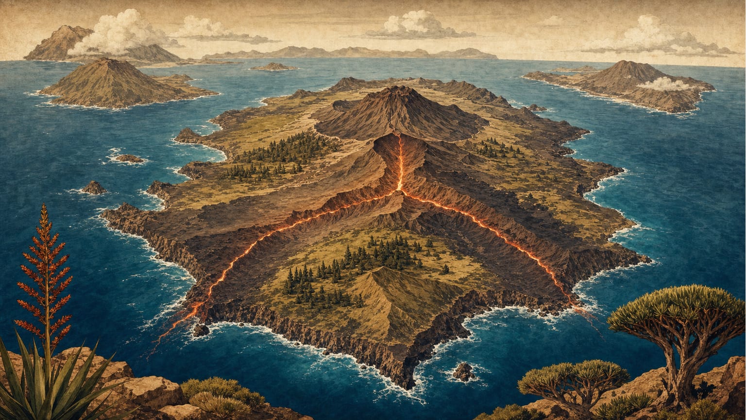
Canarian volcanism begins in the upper mantle, where a thermal anomaly or convection processes produce partial melting of peridotitic rocks and generate basaltic magma. That magma is less dense than the solid rock around it, so it rises through the oceanic lithosphere until it reaches a magma chamber or storage system located a few kilometres below the surface. From there, volcanic gas pressure and the reactivation of fractures control whether the material will continue accumulating at depth or begin an eruption. Most Canarian volcanoes align along rift structures, triangular ridges that concentrate magma ascent and shape the geometry of islands such as La Palma, El Hierro and Tenerife. The composition of the magma, its gas content and its viscosity determine the character of each eruption. Weakly evolved basalts are fluid and tend to produce effusive lava flows that advance slowly, while more evolved or gas-rich magmas can generate explosive activity, throwing out pyroclasts of different sizes. The most common products include lava flows, scoria, ash deposits and lava tubes, which form when the surface of a flow solidifies while the interior keeps moving. The interaction between ascending magma and groundwater, coastal aquifers or the sea adds complexity: it can produce phreatic or phreatomagmatic explosions, but it also favours certain textures, such as pillow lavas that form under water. Historical eruptions in the Canaries do not follow a single pattern. From the Timanfaya episodes in Lanzarote to the Teide eruptions in 1704-1705 and Teneguía in 1971, each crisis has left a distinct sequence of flows, ash and changes in relief. The two most recent crises, El Hierro in 2011-2012 and La Palma in 2021, showed how the same volcanic province can shift from a submarine eruption almost imperceptible at the surface to a continental effusive eruption that destroys buildings and forces populations to evacuate. Studying Canarian volcanism therefore requires not only understanding deep processes, but also grasping the variety of eruptive styles and the information provided by seismic monitoring, ground deformation and gas geochemistry.[1][2][3]
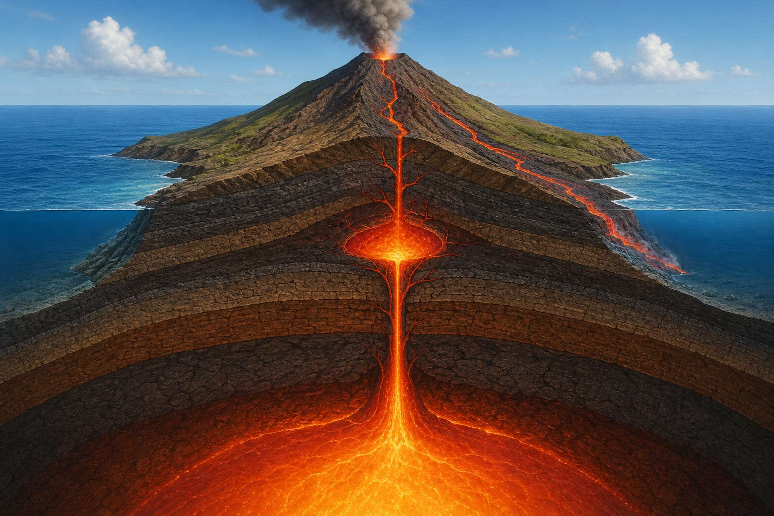
Magma generation starts with the partial melting of mantle peridotites, a process that requires a drop in pressure, heat input or the presence of volatiles such as water and carbon dioxide. In the Canaries, the ancient oceanic lithosphere that acts as basement makes pure decompression melting difficult, so current models combine a thermal anomaly with plate-edge dynamics.[1]
Once formed, magma rises through fractures and preferred pathways. When ascent is rapid and direct, the composition reaching the surface closely resembles that of the mantle source; when it stalls in intermediate chambers, it can differentiate and mix with residual magmas. This storage history explains why primitive basalts and more evolved magmas coexist on the same island.[1]
Magma chambers are not static reservoirs: they act as chemical and mechanical filters. Inside them, fractional crystallisation enriches the residual liquid in silica and volatiles, while denser crystals may settle. Mixing episodes between magmas of different ages and compositions are common and explain part of the chemical variability observed in Canarian rocks.[1]
Dikes are tabular bodies that cut through pre-existing rocks and act as feeder pathways. When a dike reaches the surface, it can generate an eruptive fissure with several aligned vents. On islands with triple rifts, dikes tend to exploit the dominant structural directions, distributing eruptions along well-defined ridges.[1]
The amount of silica, iron and magnesium oxides, together with temperature, defines magma viscosity. Canarian basalts are relatively poor in silica and therefore fluid, favouring effusive eruptions and extensive flows. However, even within basalts, small variations in gas content can change the eruptive style.[1]
Dissolved gases, mainly water vapour, carbon dioxide and sulphur, provide the pressure that drives the eruption. If gas escapes easily, activity is calm; if the rock shell confines the gas until the last moment, violent decompression can fragment the magma into ash and lapilli. This transition explains why a single eruption can alternate effusive and explosive phases.[1]
The effusive style dominates the Canarian historical record. During these episodes, lava issues from vents or fissures and advances as a flow that may travel several kilometres before cooling. The surface of the flows adopts two main textures: pahoehoe, with smooth and wrinkled skin, and aa, with angular and rough blocks. Both textures can appear in the same flow as flow conditions change.[1][2]
Explosive products, although less frequent, are important. They consist of pyroclasts, fragments of magma and rock expelled with gases. By size they are classified as bombs, lapilli and ash. Pyroclastic deposits build scoria cones and explosion craters, and can affect large areas if wind carries ash towards populated regions.[1]
When magma comes into contact with groundwater or seawater, rapid cooling can fragment the magma into glass particles and produce hyaloclastite breccias. If water enters the conduit and vaporises suddenly, steam expansion generates phreatic or phreatomagmatic explosions, capable of ejecting wet ash and forming maar craters.[1]
Under the sea, lava flows cool evenly on all sides and develop the typical pillow morphology. In the Canaries, remains of this submarine stage outcrop in places such as the Basal Complex of Fuerteventura and La Gomera, allowing the depth and growth rate of the edifice before emergence to be reconstructed.[1][2]
The historical record of the Canaries includes eruptions in Lanzarote, Tenerife and La Palma between the fifteenth and twenty-first centuries. Each event has left marks on the landscape, land use and social memory. Longpre and Felpeto have reviewed this historical volcanism, highlighting that the spatial and temporal distribution does not follow a single predictable pattern, but rather reflects the interaction between conduits, structures and the evolution of each edifice.[1]
The El Hierro crisis in 2011-2012 began with a submarine intrusion south of the island, detected by seismic swarms, ground deformation and geochemical changes. The eruption was mainly submarine and generated a discoloured plume visible at the surface. In contrast, the 2021 La Palma eruption started in the Cabeza de Vaca area, within the emerged edifice, and produced flows that reached the sea, destroying infrastructure and forcing the evacuation of thousands of people.[1][2]
Magma is the molten material beneath the surface; when it emerges, it is called lava. The distinction is not merely terminological, because decompression and gas loss modify its behaviour.
A tabular body of magma that cuts older rocks and acts as a feeder pathway between a deep chamber and the surface.
A fractured ridge through which magma ascends and along which eruptions concentrate. In the Canaries, triple-rift structures shape islands such as La Palma, El Hierro and Tenerife.
A fragment of magma, lava or rock ejected during an explosive eruption. By size it is classified as bomb, lapilli or ash.
A mass of lava that advances over the surface after leaving a vent or fissure. Its length and thickness depend on viscosity, slope and effusion rate.
Two opposing but not mutually exclusive eruptive styles. The effusive style leaves lava flows; the explosive style fragments magma and generates pyroclasts. A single eruption can alternate between both.
A thermal anomaly or convection processes generate basaltic magma from mantle rocks.
Magma rises because of density contrast and exploits fractures and weak zones in the oceanic crust.
In intermediate chambers magma may partially crystallise, differentiate and mix with other batches.
Magma is injected into dikes that cut the edifice and may reach the surface to form eruptive fissures.
Lava or pyroclasts exit to the surface and accumulate as flows, cones or ash deposits.
Contact with water generates explosions or pillow textures; eventually the whole body cools and is fixed in the landscape.
The El Hierro crisis began in July 2011 with a seismic swarm interpreted as magma ascending from intermediate depths towards the southern edge of the island. For months, seismic activity, deformation and changes in gas emissions monitored by the IGN allowed the evolution of the intrusion to be reconstructed. The final eruption was submarine, with pillow-lava emissions and a visible surface plume, but without direct danger to the population.[1][2]
The 2021 La Palma eruption represented the opposite pole: a fissure on emerged land that emitted fluid basaltic flows for roughly three months. The flows destroyed buildings, infrastructure and crops, and on reaching the sea generated a coastal lava platform. The PEVOLCA response included the preventive evacuation of thousands of people and continuous monitoring of air and water quality. Both cases show that eruptive style shapes risk management as much as event magnitude.[1][2]
Institutional tools for consulting maps, monitoring and planning.
Reference mapping by sheets from IGME-CSIC.
Real-time seismic, deformation and gas geochemistry data for the Canary Islands.
Technical reports, lava-flow maps and activity summaries published by the IGN.
Official framework for volcanic risk management, scenarios and response protocols in the Canary Islands.