

Hazard
Propensity for a potentially damaging natural phenomenon to occur at a given place and intensity.
Distinguishing hazard, exposure, vulnerability and risk to monitor the Canarian volcanoes with dated data and official protocols.
The Canarian archipelago hosts active volcanoes, so it is important to distinguish rigorously between hazard, exposure, vulnerability and risk. Hazard is the propensity of a natural phenomenon to occur at a given place and intensity: an eruption, a flank landslide or a seismic reactivation. Exposure depends on how many people, assets or services are located in the affected area. Vulnerability measures the ability of those elements to withstand or recover. Risk is the combination of these factors, not an intrinsic property of the volcano. Confusing hazard with risk leads to over- or under-estimating the measures required. Volcanic monitoring in the Canaries falls mainly to the Instituto Geográfico Nacional and the agencies integrated in the Special Civil Protection and Emergency Plan for Volcanic Risk, known as PEVOLCA. The monitoring network combines seismometers, ground-deformation stations, geochemical gas analyses, and thermal and satellite techniques. None of these techniques, taken in isolation, allows an eruption to be predicted; only their continuous integration offers a picture of the state of the volcanic system and of possible short-term evolutions. Monitoring data must be read with an explicit date and source. The seismic catalogue revised by the IGN, the reports on the 2021 La Palma eruption and PEVOLCA technical documents are public references that allow claims to be checked and alarmism to be avoided. Exact prediction of the time, place and magnitude of an eruption remains impossible; what science can offer is an estimate of probabilities and scenarios, which emergency managers translate into civil-protection measures.[1][2][3][4]
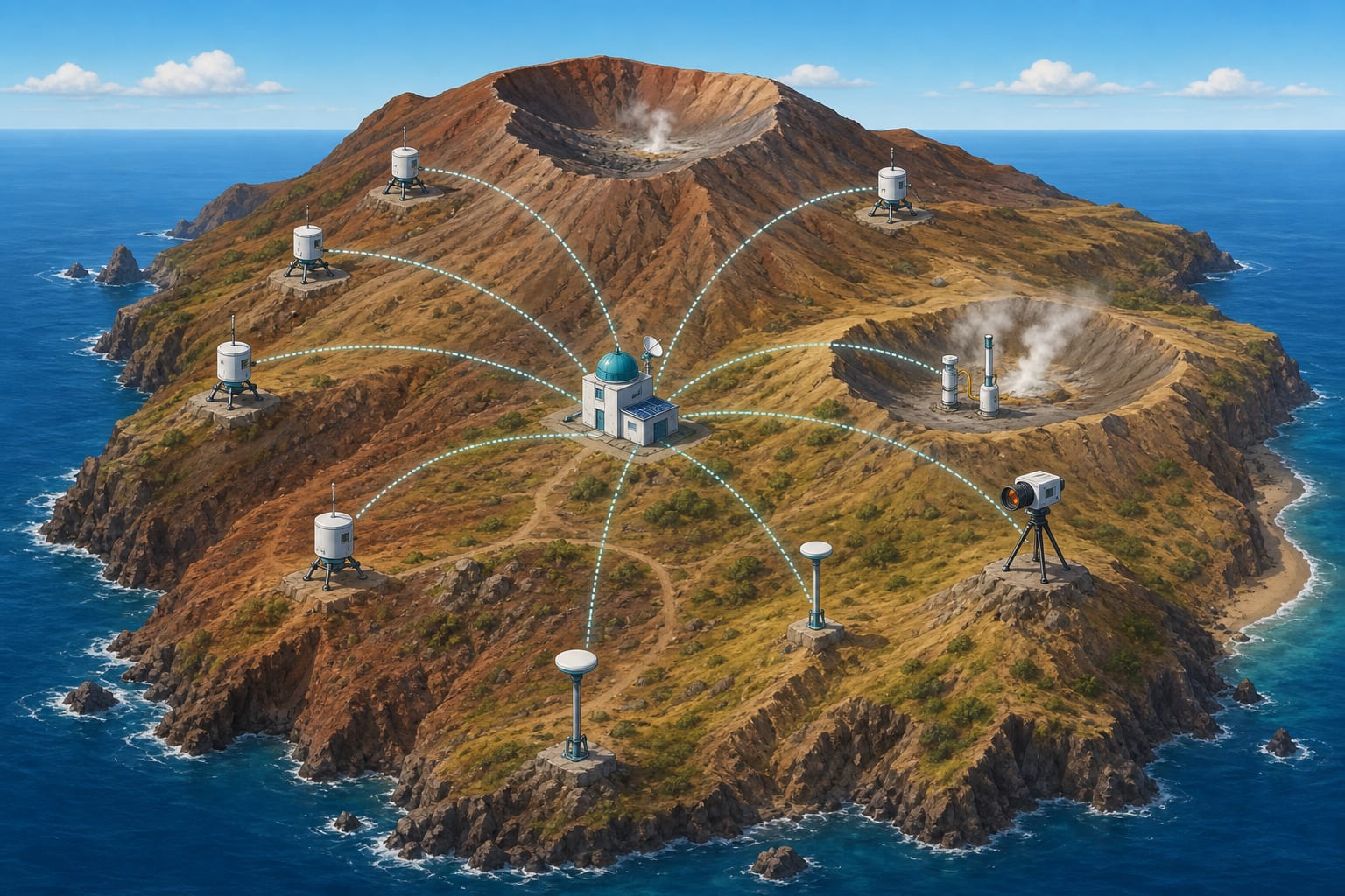
Volcanic hazard describes what may occur and how often it is expected: effusive or explosive eruptions, pyroclast fallout, lava flows, gases, earthquakes or flank landslides. In the Canaries, hazard is not uniform: it is higher in La Palma and El Hierro, where historical activity is recent, and lower in islands such as Fuerteventura or La Gomera, now inactive from a historical point of view.[1][2]
Exposure grows wherever population, infrastructure or essential services concentrate in areas of higher hazard. Vulnerability depends on construction quality, institutional response capacity and the population’s perception of risk. A distant volcano may represent no risk if no one lives within its reach, while a small eruption near a densely populated area may have high consequences.[1][2]
The IGN seismic network records activity in near real time and locates earthquakes associated with magma ascent, fault reactivation or adjustments of the volcanic edifice. The revised IGN seismic catalogue provides a homogeneous basis for studying the spatial and temporal distribution of earthquakes in the archipelago.[1]
A seismic swarm is not, by itself, a prediction of eruption. It indicates that the volcanic system is disturbed, but seismicity can rise and fall without leading to an eruption. Interpretation requires comparing depth, location and temporal evolution with other monitoring parameters.[1][2]
Ground deformation indicates changes in the volume or pressure of a magmatic system. It is measured with GPS stations, tiltmeters and satellite radar interferometry. In episodes such as El Hierro in 2011 or La Palma in 2021, deformation preceded the eruption and helped to constrain the likely location of the focus.[1][2]
However, deformation does not always signal an imminent eruption. Volcanic edifices can inflate or deflate because of fluid movements, hydrothermal adjustments or deep processes with no direct link to a future eruption. That is why it is interpreted together with seismicity and geochemistry.[1][2]
The composition and flow of volcanic gases, especially sulphur dioxide and carbon dioxide, change when magma approaches the surface or when the hydrothermal system is altered. Systematic measurement in fumaroles, mofettes and soils makes it possible to detect trends that, combined with other data, reflect the state of the volcano.[1][2]
Thermal techniques, including infrared satellite imagery, provide information on zones of anomalous heating. They are most useful once eruptions have begun, when lava flows or hot deposits are visible, but they can also detect precursors in areas of gas discharge.[1]
Modern monitoring integrates seismicity, deformation, gases, thermal and hydrogeology into models that try to represent the state of the volcanic system. No model is definitive: every interpretation depends on data quality, initial assumptions and the incomplete knowledge we have of deep magmatic pathways.[1][2]
Uncertainty is not a failure of science but an inherent feature of complex volcanic systems. Expressing it clearly is as important as collecting data, because it allows society to prepare for different scenarios without falling into paralysis or alarmism.[1][2]
Exact prediction of the time, place and style of a volcanic eruption is not possible with current technology. What monitoring can offer are updated probabilities and plausible scenarios that allow authorities to make gradual decisions. This limitation must be understood as part of the normal functioning of scientific knowledge, not as a hidden shortcoming.[1][2]
When monitoring detects signals compatible with an imminent eruption, the response cannot wait for absolute certainty. Risk management combines scientific knowledge with precautionary criteria, evacuation plans and transparent communication in order to reduce the impact on exposed populations.[1][2]
PEVOLCA is the official framework that coordinates the response to a volcanic emergency in the Canaries. It defines alert levels, administrative responsibilities and action protocols. During the 2021 La Palma eruption, PEVOLCA served as the axis for evacuating populations, managing infrastructure and public communication.[1][2]
Scientific communication during a crisis must translate uncertainty into understandable messages. The daily IGN reports and PEVOLCA briefings during La Palma 2021 exemplify how coordination between technicians and managers can keep the population informed without generating false expectations of prediction.[1][2]
Propensity for a potentially damaging natural phenomenon to occur at a given place and intensity.
Presence of people, assets or services in areas that could be affected by a natural hazard.
Capacity of exposed elements to withstand, adapt or recover after an adverse event.
Combination of hazard, exposure and vulnerability; it is not a property of the volcano but a measure of expected consequences.
Distribution in time and space of earthquakes, used as an indicator of stress state and possible magma movement.
Change in shape or volume of the volcanic edifice measured with GPS, tiltmeters or radar interferometry.
Systematic measurement of the composition and flow of volcanic gases to detect changes in the magmatic or hydrothermal system.
The seismic network locates a concentration of earthquakes that may reflect magma ascent or fault reactivation.
GPS and radar interferometry detect swelling or subsidence of the edifice, indicating pressure or volume changes.
The composition and flow of volcanic gases are measured to detect magma approach or hydrothermal changes.
Scientists combine seismicity, deformation and geochemistry in models that estimate the state of the system and possible scenarios.
Authorities and scientists translate the information into alert levels and civil-protection measures, without claiming exact predictions.
The 2011-2012 El Hierro crisis began with a seismic swarm, ground deformation and discoloured water patches south of the island. The eruption was submarine and did not cause serious direct damage, but it forced PEVOLCA to activate monitoring and communication protocols for an event without precedent in the Canarian historical context.[1][2]
The 2021 La Palma eruption followed a different sequence: increasing seismicity, deformation and gases preceded an effusive eruption on land that lasted from September to December. IGN reports documented the daily evolution of activity and lava flows, while PEVOLCA managed evacuations and civil-protection measures.[1][2]
Comparing both episodes shows that there is no single universal precursory sequence. El Hierro alerted to the need for submarine monitoring; La Palma showed how a prolonged effusive eruption can affect infrastructure and population within days. Both cases underline that integrated monitoring and transparent communication are as important as the collection of technical data.[1][2][3]
Institutional tools for consulting maps, monitoring and planning.
Networks of seismometers, GPS and geochemistry with updated data from the Instituto Geográfico Nacional.
Homogeneous database of seismic data for studying activity in the archipelago.
Official IGN documentation on the Cumbre Vieja volcano eruption.
Official framework for responding to volcanic emergencies in the Canaries.