Oceanic lithosphere
Earth’s rigid outer layer beneath the oceans, made of crust and part of the upper mantle. In the Canaries it is ancient and acts as basement for the volcanic edifices.
From the ocean floor to island edifices shaped by growth, erosion and renewed volcanism.
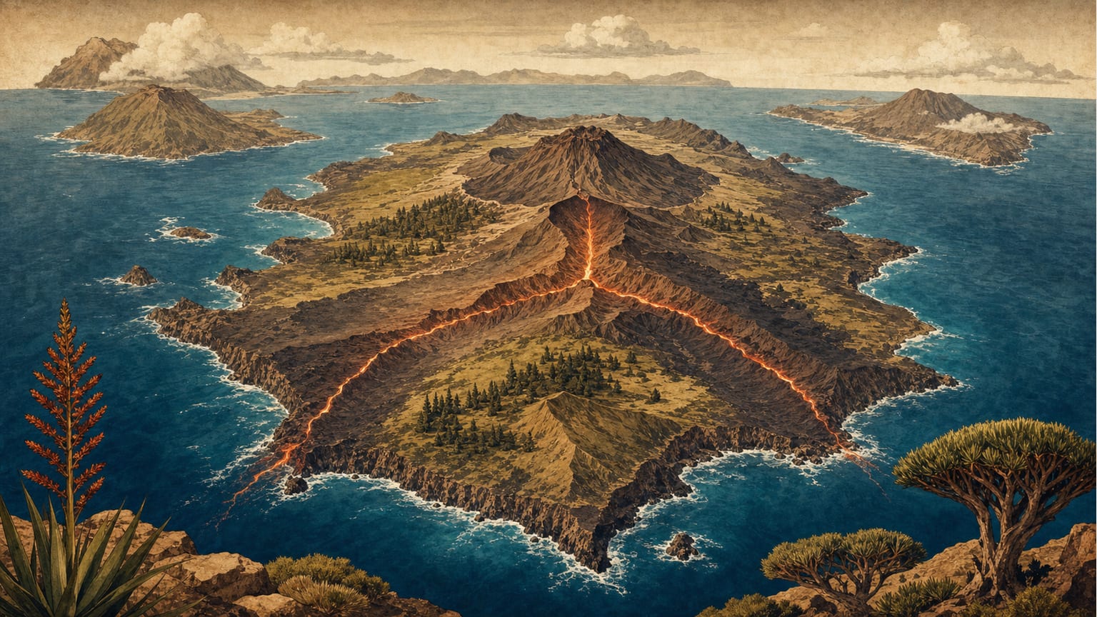
The Canaries are an intraplate volcanic province on oceanic lithosphere beside the north-western margin of Africa. Before any island emerged, the process began on the seabed: seamounts that may represent more than ninety per cent of the total volume of each edifice. The visible part is therefore only the tip of a much larger structure. Each island preserves its own stages and rhythms: some show emerged volcanism tens of millions of years old, while others are geologically very young and still under construction. Between these extremes lie shield-growth phases, erosional pauses, flank collapses and rejuvenation episodes that force us to read island history with more nuance than a simple progression from old to young islands.[1][2]
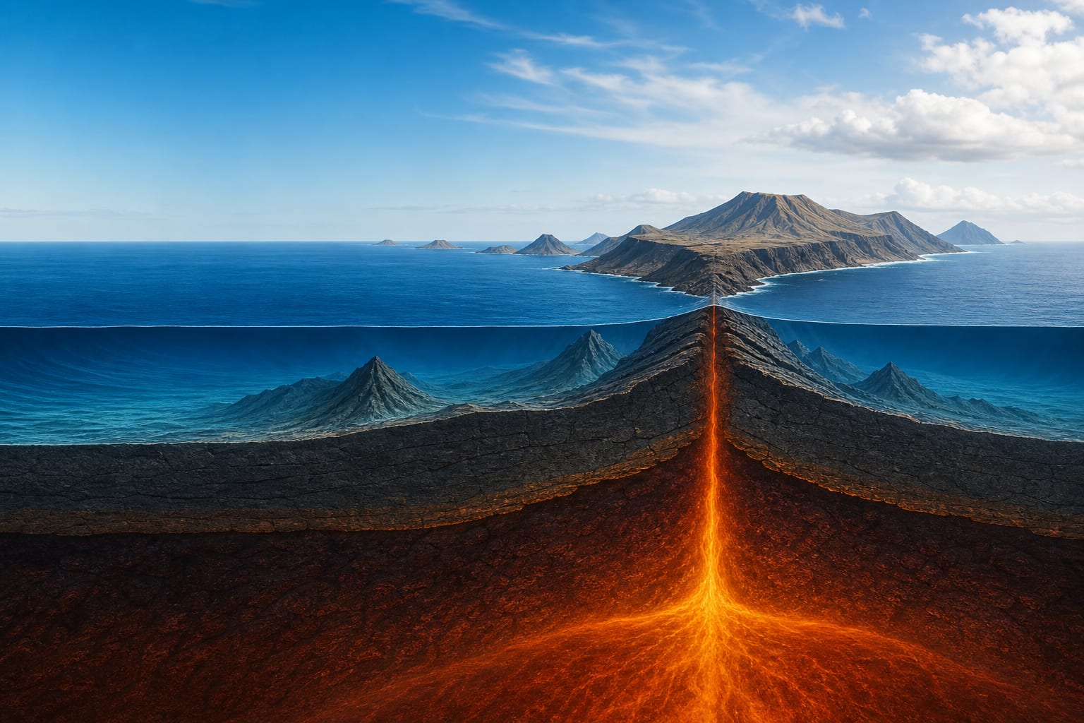
The geodynamic setting of the Canaries is defined by their position on oceanic plate, close to a passive continental margin. The underlying crust is oceanic and very old, and the African plate moves slowly north-eastwards. This configuration explains why the archipelago does not form on an active plate boundary, but in an intraplate setting where a thermal anomaly or mantle convection can trigger partial melting.[1][2]
This situation forces us to distinguish three separate ages: the antiquity of the oceanic crust that acts as basement, the age of the seamount that preceded emergence, and the age of the volcanic materials now visible at the surface. Confusing them leads to interpreting an island as “born” at the moment when its oldest rocks outcrop, when much of its earlier history remains beneath the sea.[1][2]
The submarine stage precedes any visible island. During this stage pillow lavas, hyaloclastite breccias and marine sediments accumulate on oceanic crust, forming an edifice that only later reaches sea level. In the Canaries, remnants of this stage outcrop in Fuerteventura, La Gomera, La Palma and possibly northern Anaga in Tenerife.[1][2]
On this base rests the Basal Complex, a suite of deep-seated, crustal and sedimentary rocks that reflects the transition from a submarine to an emergent environment. Its study makes it possible to reconstruct the depth at which the first materials originated and the speed at which the edifice grew upward.[1]
Once emerged, the edifice enters the shield stage, during which more than ninety per cent of the emerged volume is emitted. Very fluid basaltic lava flows stack up to form a gently sloping cone. In the Canaries, however, growth is not symmetrical: triple-rift structures shaped like three-armed stars channel magma and distribute eruptions along ridges that shape the silhouettes of La Palma, El Hierro and Tenerife.[1]
As the system evolves, the magma pathways reorganise. Some rifts stop being fed and new fracture zones control magma ascent. This reorganisation explains why a single island may accumulate several volcanic centres of different ages and orientations, and why later episodes can re-use old lines of weakness.[1][2]
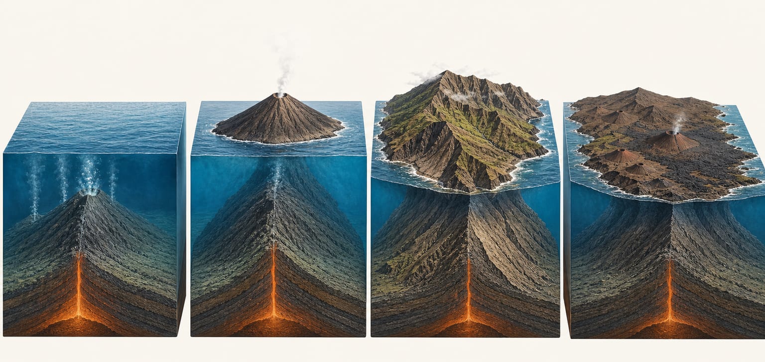
After the shield stage, many islands pass through a long erosive period during which ravines, cliffs and valleys dismantle the edifice. In some cases, flank instability produces giant landslides that remove whole sectors of the volcano and leave amphitheatres open to the sea. Later rebuilding with new lava flows can mask part of this dismantling, but submarine deposits preserve the evidence.[1][2]
Post-erosive rejuvenation reactivates volcanic centres or opens new eruption points. In the Canaries this phenomenon is more intense than in Hawaii, which some authors attribute to the slower movement of the African plate. Subsidence, by contrast, appears less pronounced than in other hotspot archipelagos, complicating direct comparisons.[1]
The classic hotspot model explains magma production by a persistent mantle source over which the lithospheric plate moves. Applied to the Canaries, it predicts that young volcanism would concentrate at the western end of the archipelago, close to the present hotspot location, while the eastern islands would trail behind. Carracedo and collaborators have defended this reading, pointing out that Quaternary activity concentrates in La Palma and El Hierro.[1]
However, the comparison with Hawaii is not exact. In the Canaries the ages of the islands do not decrease as linearly as in the Hawaiian paradigm, and the distribution of historical and prehistoric volcanism shows nuances that do not fit a simple progression perfectly. The hotspot model is therefore presented as a testable hypothesis, not as a closed consensus.[1]
Paul van den Bogaard and other researchers have proposed that edge-driven convection, together with interaction between the oceanic plate and the African margin, could help explain the long history of seamounts in the Canary province. Dating of old seamounts suggests activity predating several emerged edifices, complicating any reading based solely on the ages of visible islands.[1]
This proposal does not completely replace the hotspot model; it suggests that several mechanisms may act simultaneously. The open question remains how much of Canary activity is due to a deep mantle anomaly, how much to plate-edge dynamics and how much to the re-use of inherited fractures.[1][2]
Earth’s rigid outer layer beneath the oceans, made of crust and part of the upper mantle. In the Canaries it is ancient and acts as basement for the volcanic edifices.
Suite of deep-seated, crustal and sedimentary rocks that records the transition from a submarine environment to island emergence.
Main growth stage of an island edifice, during which fluid basaltic lava flows build a gently sloping cone.
Return of volcanic activity after a long erosive period. In the Canaries it is more intense than in Hawaii and complicates simple sequence reconstructions.
Upwelling magma pressure and regional stresses create weak zones in the oceanic lithosphere. These fractures become preferred corridors for future dykes and eruptions.
Before any visible island exists, deep-seated rocks, oceanic sediments, pillow lavas and a network of dykes accumulate. This core, the Basal Complex, outcrops today in Fuerteventura, La Palma and La Gomera.
When volcanic materials rise above sea level, erosion begins to act at the same time as eruptions. From then on the edifice grows in layers: lava flows, pyroclasts, buried cones and reddened soils between episodes.
On young islands, many eruptive vents concentrate in rifts or ridges. Their geometry shapes the island’s form, the direction of lava flows and the zones where volcanic risk may be highest.
The weight of thousands of metres of lava, repeated dyke injection and gravity cause faults, tilting and giant flank landslides. Valleys such as La Orotava, Güímar, El Golfo and Aridane reflect this dynamic.
The sea cuts cliffs, runoff excavates ravines and wind shapes exposed surfaces. But the story does not always move towards decay: recent lava flows can cover valleys, fill depressions and create new coastal platforms.
La Palma and El Hierro; Tenerife in a late phase
Tall edifices, superposed lava flows, dyke swarms and active ridges predominate. The island gains mass faster than erosion can remove it.
La Gomera as a clear reference
Volcanism weakens or disappears for long intervals. Rain, sea and gravity open ravines, dismantle old ridges and expose deep materials.
Fuerteventura, Gran Canaria and Lanzarote
On already lowered reliefs, new eruptive pulses appear: isolated cones, malpaíses, lava fields and platforms that can gain ground from the ocean.
Fuerteventura embodies the ancient eastern end: it preserves Basal Complex outcrops and shows an edifice deeply dismantled by erosion, with no historical activity. Tenerife represents the dynamic centre: superposition of volcanic centres, triple rifts that shape its silhouette and historical volcanism in its recent series. La Palma, at the western end, is one of the youngest and most active edifices, with historical eruptions from the sixteenth century to 2021.[1][2][3]
This comparison shows that the age of emerged materials is not the same as the total age of the edifice. Fuerteventura already existed as a seamount long before La Palma began to form, yet both islands share the same type of oceanic basement. Understanding these differences is key to avoiding a reduction of Canarian geology to a mere progression from old to young.[1][2]
The formation order helps read the archipelago from east to west, but the figures refer to approximate ages of emerged materials, not the absolute beginning of each submarine edifice.
Institutional tools for consulting maps, monitoring and planning.
Reference mapping by sheets from IGME-CSIC.
Island relief and seabed in a single IEO-CSIC map.
van den Bogaard (2013) paper with ages of old seamounts and the origin debate.