Why this island matters
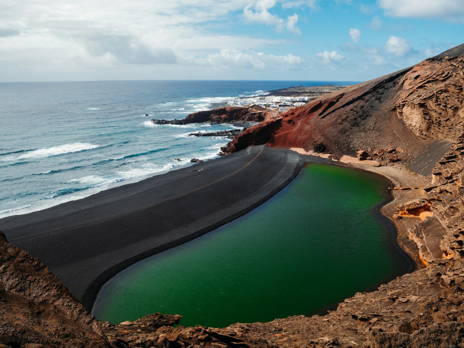
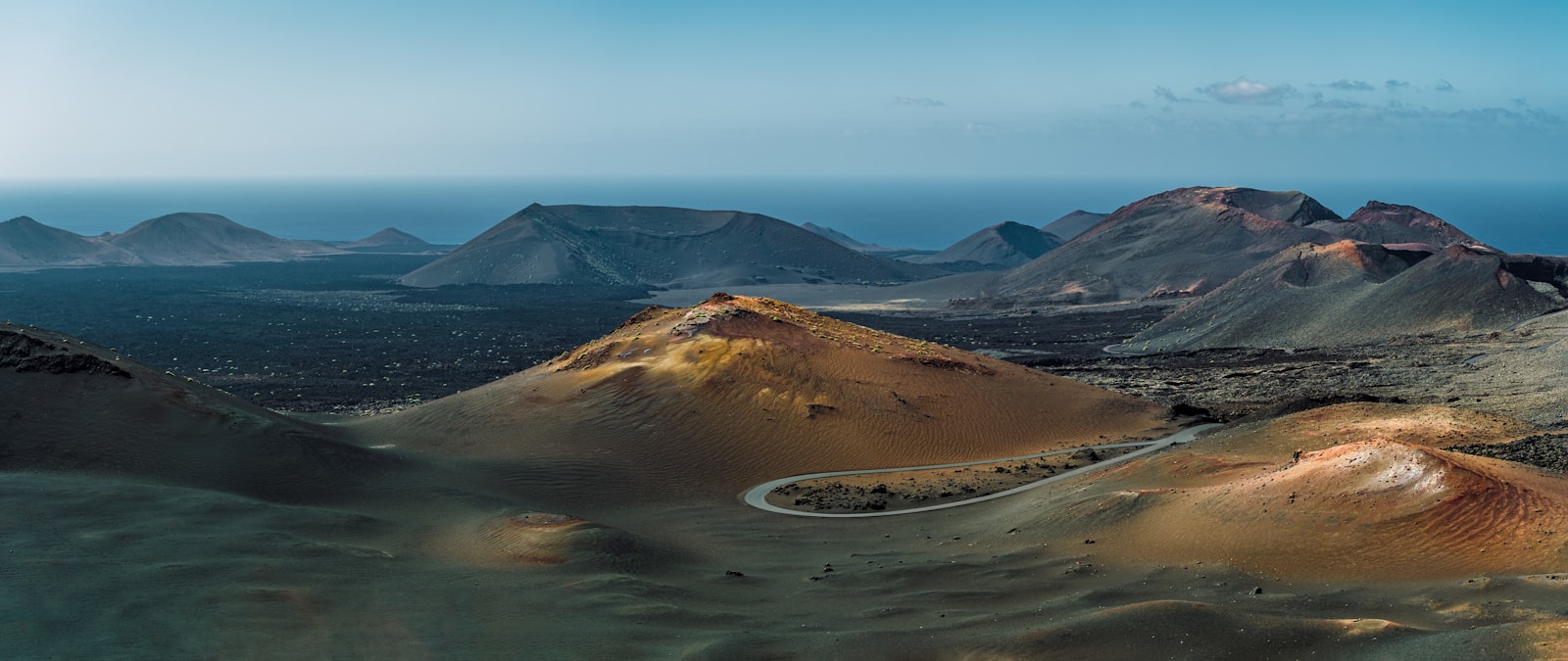
It was one of the first islands known to European navigators and played an early role in seigneurial conquest. Later, the great Timanfaya eruptions of the eighteenth century transformed settlements, farmlands and collective memory, leaving the scenario that still defines the island's global image today.
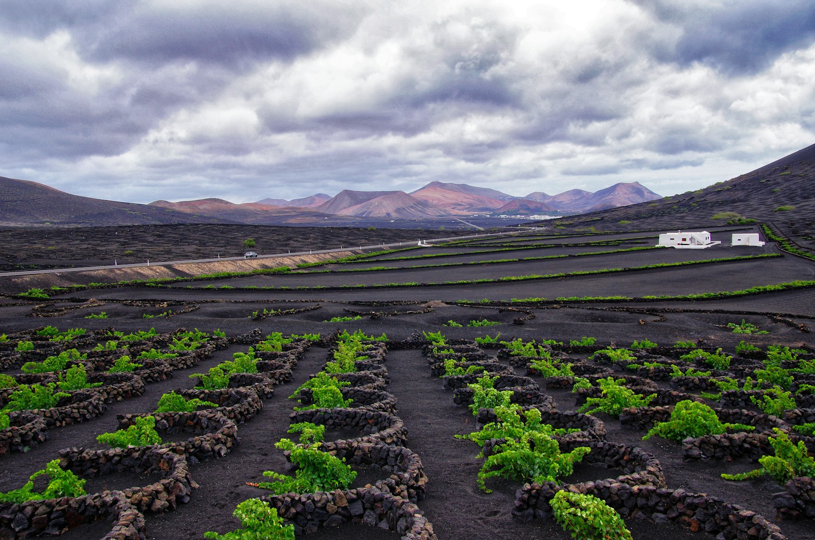
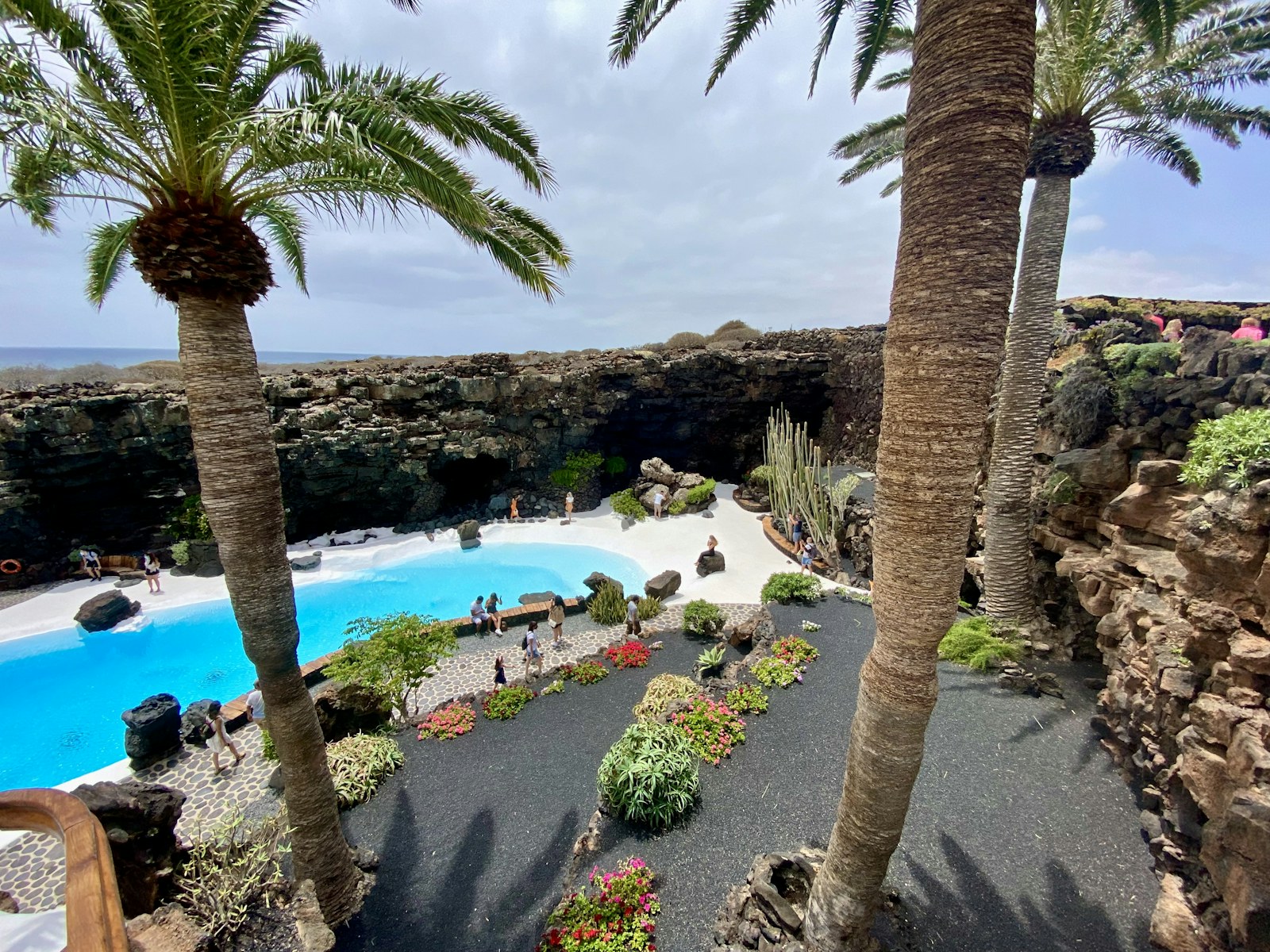
Lanzarote's contemporary imprint cannot be understood without the work of César Manrique and the peasant tradition that learned to cultivate on ash and lapilli. Jameos, wineries and whitewashed villages coexist with volcanic cones and recent lava flows in one of the most singular cultural compositions of the Canary Islands.
Cultural landscape
Lanzarote's contemporary imprint cannot be understood without the work of César Manrique and the peasant tradition that learned to cultivate on ash and lapilli. Jameos, wineries and whitewashed villages coexist with volcanic cones and recent lava flows in one of the most singular cultural compositions of the Canary Islands.
Municipalities and territories
See all 7 municipalities of Lanzarote →- ArrecifeArrecife is a municipality of Lanzarote, presented through settlement, landscape, local memory and its links with the rest of the island.
- HaríaHaría is a municipality of Lanzarote, presented through settlement, landscape, local memory and its links with the rest of the island.
- San BartoloméSan Bartolomé is a municipality of Lanzarote, presented through settlement, landscape, local memory and its links with the rest of the island.
- TeguiseTeguise is a municipality of Lanzarote, presented through settlement, landscape, local memory and its links with the rest of the island.
- TíasTías is a municipality of Lanzarote, presented through settlement, landscape, local memory and its links with the rest of the island.
- TinajoTinajo is a municipality of Lanzarote, presented through settlement, landscape, local memory and its links with the rest of the island.
- YaizaYaiza is a municipality of Lanzarote, presented through settlement, landscape, local memory and its links with the rest of the island.
La Graciosa is an inhabited island north of Lanzarote, administratively part of Teguise and linked to the Chinijo Archipelago.
Explore the island
Themes to understand Lanzarote
Each block summarizes a line of interpretation and links to its own page. The main island page works as an entry point; the sections expand geography, history, nature, heritage and social life without turning this hub into a single long article.
Geography
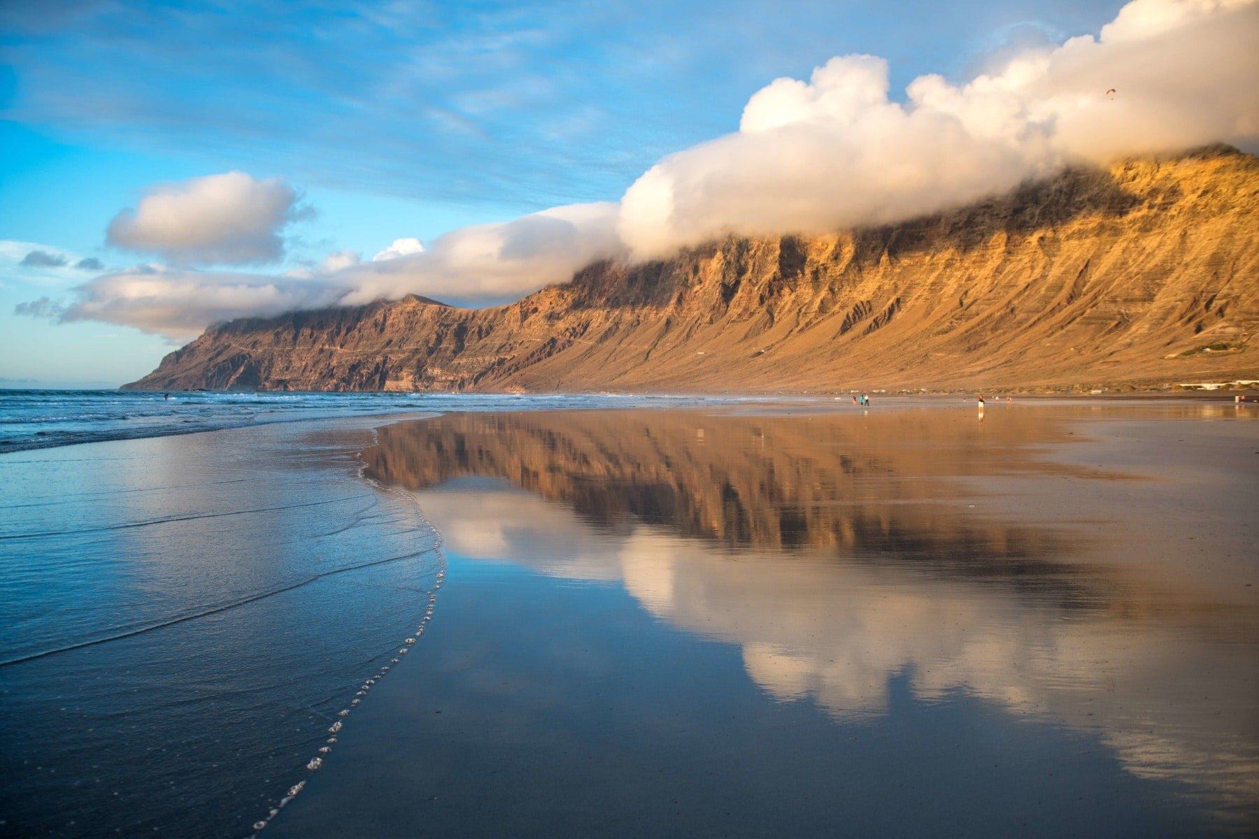
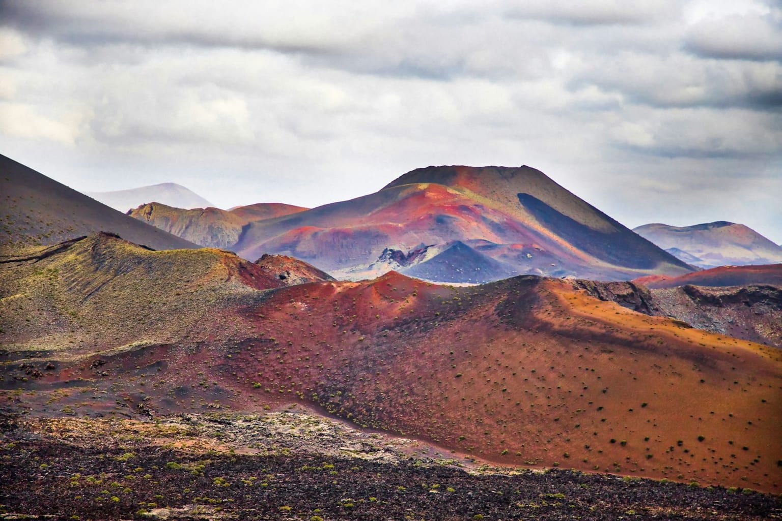
Lanzarote is read through its relief, its coastline and the contrast between interior and coast. Lava, wind and white architecture: an island that turned the volcano into a visual language and way of life.
Explore sectionHistory
It was one of the first islands known to European navigators and played an early role in seigneurial conquest. Later, the great Timanfaya eruptions of the eighteenth century transformed settlements, farmlands and collective memory, leaving the scenario that still defines the island's global image today.
Explore sectionNature
Lanzarote's natural identity brings together landscape, biodiversity and ways of inhabiting a fragile island territory.
Explore sectionFlora
The flora of Lanzarote reflects altitude, exposure, humidity and long adaptation to volcanic soils and island isolation.
Explore sectionFauna
The fauna of Lanzarote is best understood through its habitats: coast, ravines, summits, cultivated areas and marine environments.
Explore sectionHeritage
Lanzarote's contemporary imprint cannot be understood without the work of César Manrique and the peasant tradition that learned to cultivate on ash and lapilli. Jameos, wineries and whitewashed villages coexist with volcanic cones and recent lava flows in one of the most singular cultural compositions of the Canary Islands.
Explore sectionCulture and Traditions
Living culture in Lanzarote connects festivities, oral memory, food, trades and community practices shaped by the island's geography.
Explore sectionEconomy and Society
Lanzarote's society has been shaped by production, mobility, ports, migration and the changing value of its landscapes.
Explore sectionMunicipalities and Territories
The internal geography of Lanzarote explains the contrast between capital, towns, coast, midlands and summit areas.
Explore sectionKey Places
Key places in Lanzarote work as entry points into its natural, historical and symbolic meanings.
Explore sectionLinked Figures
The figures linked with Lanzarote help turn broad historical processes into concrete biographies and local memory.
Explore sectionIsland Chronology
The chronology of Lanzarote connects Indigenous history, conquest, economic change, cultural life and recent transformations.
Explore section