Gran Canaria's society has been shaped by production, mobility, ports, migration and the changing value of its landscapes.
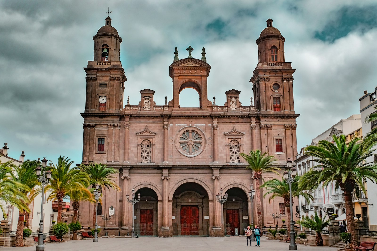
The Castilian campaign culminated in 1483 after a violent process that profoundly transformed the territory and indigenous political structures. With the foundation of Las Palmas and the establishment of the bishopric, the island acquired a decisive role in Canarian administration and in the Atlantic routes of the early modern period. The island economy has changed according to available resources, external connections, population mobility and pressure on the territory.
Among its main reference points are Historic Las Palmas, Aboriginal landscape, Natural contrasts, which connect landscape, memory and everyday life. This section links production, society and landscape to explain the contemporary island without separating it from its history.
Key points
Puerto de la Luz: nodo atlantico
El Puerto de la Luz de Las Palmas es uno de los mayores puertos del Atlantico, con funciones de cabotaje, pesca, cruceros y contenedores desde su apertura en 1883.
Turismo de Maspalomas y el sur
Maspalomas, San Agustin y Playa del Ingles configuran el mayor polo turistico del archipielago, con una transformacion urbanistica y demografica radical desde los años 60.
Emigracion a America y retorno
La emigracion de grancanarios a Cuba, Venezuela y otros paises americanos durante el siglo XIX y XX genero vinculos economicos y culturales todavia vivos.
Zona Franca y actividad comercial
Las Palmas tuvo desde el siglo XVI privilegios portuarios y comerciales que la convirtieron en escala estrategica en el comercio entre Europa, Africa y America.
Municipalities of Gran Canaria
See all →- Agaete Agaete es el municipio del noroeste de Gran Canaria, con el Puerto de Las Nieves, las termas naturales de La Laja y la fiesta de La Rama como expresión colectiva más antigua de la isla.
- Agüimes Agüimes es un municipio del sureste con un casco histórico bien restaurado y el Barranco de Guayadeque como entorno arqueológico de primera importancia para la prehistoria canaria.
- Artenara Artenara es el municipio de mayor altitud de Gran Canaria, con casas-cueva excavadas en la toba volcánica de las cumbres y el mirador de la Ermita de la Cuevita como referencia panorámica.
- Arucas Arucas es la capital del norte agrícola de Gran Canaria, con la Catedral de San Juan Bautista —llamada popularmente la catedral de Arucas— y una industria del ron que ha definido la economía local.
- Firgas Firgas es conocida por el Paseo de Gran Canaria con sus murales hidráulicos y por el agua mineral embotellada que lleva el nombre del municipio, una de las más consumidas en las islas.
- Gáldar Gáldar fue la capital del reino prehispánico del noreste y alberga la Cueva Pintada, el yacimiento de arte rupestre canario más importante y uno de los conjuntos prehistóricos más relevantes del Atlántico.